Politics & Government
Tolland Village Area Approved
After years of discussion, the planning commission creates a unique development zone to encourage the evolution of a walkable and appealing village center at Exit 68 and Route 195.


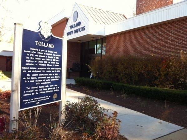
Where is Tolland’s main street?
One local developer says he doesn’t know, and doubts it will ever be built.
But Planning and Zoning Commission members say the chances are better than ever that it will be created under the new zoning district they approved Monday by unanimous vote.
Find out what's happening in Tollandwith free, real-time updates from Patch.
At least six years in the making, the Tolland Village Area is intended to encourage the evolution of a “village-style town center” on both sides of Route 195 north of the Exit 68 interchange at Interstate 84.
As the commission members explained to one frustrated owner of property in the zone, the new regulations intensify land use in the village center and grant maximum land use to developers who collaborate under its rules.
Find out what's happening in Tollandwith free, real-time updates from Patch.
The overall concept is to guide the next decades of development toward creation of an environment that is pedestrian friendly, human scale, and visually appealing in the style of a traditional New England village.
“I remain hopeful that that changes will make for a better community as a whole,” commission Chairman Michael Cardin said.
Design guidelines adopted at Monday’s meeting set standards for everything from street and sidewalk configuration to the lettering on retail store windows. The new regulations prohibit single-story commercial buildings or anything taller than three stories. The standards were developed with input from local residents in a series of workshops.
The Tolland Village Area concept calls for areas of single-family homes and townhouses near retail and commercial development in densities much higher than currently allowed.
Planners estimate that the proposal would nearly triple the current housing density and double the commercial square footage available in the town center. The economic effect of increasing the density could cause tax revenues to the town to more than double, going from a projected $341,000 under current zoning, to $719,000, they said.
The idea is to encourage the intense land use – and reap increased tax revenues – in an area where the town already has water, sewer and infrastructure to support it.
The proposal approved Monday had been tweaked slightly in response to property owners’ concerns raised three weeks ago. Specifically, a conceptual use map developed earlier was amended to allow for mixed uses – retail, hospitality, or commercial use with residential above – to accommodate Michael Taylor, a Storrs developer who owns 26 acres west of Route 195. At a previous meeting, Taylor had said there might be some interest in locating a hotel there.
The diagram was amended again Monday night at his request to allow for residential, commercial or retail land use in a small area along Route 195 just north of the existing retail area. Taylor said there may be interest in locating a pharmacy there, but still wanted to preserve his options to build residential units.
The commission’s flexibility did nothing to placate developer Stephen Williams, who appeared Monday to say the new regulations are ill considered and fraught with engineering and other practical problems that render the concept economically infeasible.
Williams owns a large parcel behind the Dunkin Donuts building on the west side of Route 195. The commission has designated that area for mixed use and potential development of a hotel or similar structure to anchor a conceptual “main street.”
But “where is Main Street on your conceptual plan?” Williams asked. “Where does it start?”
He said it would be impossible to coordinate his development plans with those of adjoining property owners if they had no current plans to use their land. Without a comprehensive plan for the entire area, he said, one developer’s work – on establishing the grade, for example - could preclude chances of fitting adjoining properties into the concept.
“It wouldn’t make it as easy, but it would not preclude it,” Linda Farmer, Tolland’s director of planning, said.
“This commission cannot tell you where Main Street is until other property owners come in,” Cardin told Williams.
The drawings prepared by town planners are only conceptual, several commissioners said.
The area’s configuration will evolve as properties are built out over the decades, they said, and there is nothing in the rules that would mandate one property owner from cooperating with others. However, the new rules permit the most flexible – and potentially profitable - use of land for building, open space and parking when the uses are coordinated among nearby properties.
Another element of the plan that will evolve over time is the connector road proposed to snake east from Cider Mill Road to intersect Route 195, then extend further west through the largest area designated for commercial and residential use.
In a memo to the commission, Fire Chief John Littel said he is concerned that the connector will generate heavy traffic that could potentially hamper the movement of fire trucks and ambulances. The intense development of the area in general would create an additional demand for public safety and emergency services, he added.
The commission members have said any road designs and future site plans will contemplate traffic and emergency-service needs. The idea behind the connector is to encourage “connectivity” in the community and help disperse rather than funnel traffic in and out of the area, they said.